Three, two, one, ignition — and liftoff.” It’s a bright, beautiful morning as a SpaceX rocket descends from Cape Canaveral Cosmodrome into a cloudless sky. Space enthusiasts around the world follow the live broadcast at its office in Munich , Björn Stauffers vested to colleagues of the Ororetec start-up. They have been working to this day for five years. At 5:33 pm German time, the control center said: “Ororetec separation confirmed.” Launch vehicle successfully launched Auroretech satellite into orbit.The team in Munich is delighted, a dream come true for the founders.
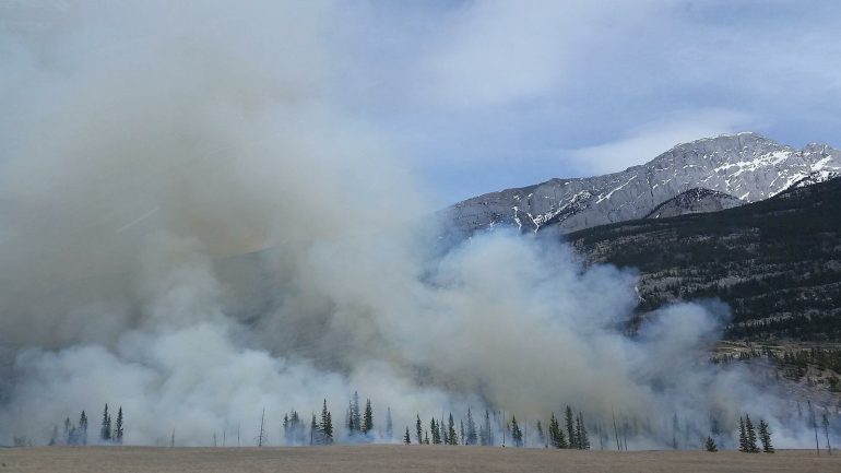
50 percent more forest fires by the end of the century
This should be the start of a support mission from space to the world’s forests. Because soon the satellite will use a thermal imaging camera to detect and report wildfires around the world so quickly that they cause as little damage as possible. This is becoming more important as the risk of forest fires increases with climate change. The United Nations recently predicted 50 percent more severe fires by the end of the century. In the past, lookout posts on the watchtower were used to look for sources of flame. Today, forest wardens fly over treetops in airplanes or helicopters, and drones are also deployed.
In accessible areas, pivoting cameras are installed on mobile phone masts or old watchtowers. But it is time consuming and is usually only suitable for commercial forests. “You can’t equip the entire Amazon with cameras,” says Bjorn Stauffers. So Earth observation satellites have been providing information about wildfires all over the world for some time. However, images taken from a distance of 36,000 kilometers are not very accurate for early detection in real time. The Auroratec satellite flies at an altitude of just 525 kilometers and can detect and report fires from 100 square meters in size.
The nano-satellite is only the size of a shoe box. It is so small because specially developed infrared cameras do not normally require the cooling required. “With cooling, the satellite would be significantly larger, more complex – and much more expensive,” says Björn Stauffers. In addition to the camera, engineers have integrated a processor into the satellite, which processes the recordings in space and sends its warnings to Earth like a sort of SMS. This is much faster than the normal transmission of several gigabytes of raw data to a ground station.

Claire Montgomery is a contributor to CA News Ottawa, covering news, politics, business, technology, sport, entertainment, and lifestyle. She focuses on clear, accurate reporting and useful information that helps readers stay informed about current affairs and developments that shape their communities. Her work highlights relevant stories, emerging trends, and important issues, presenting them in a balanced, accessible, and reader-friendly manner.